|
|
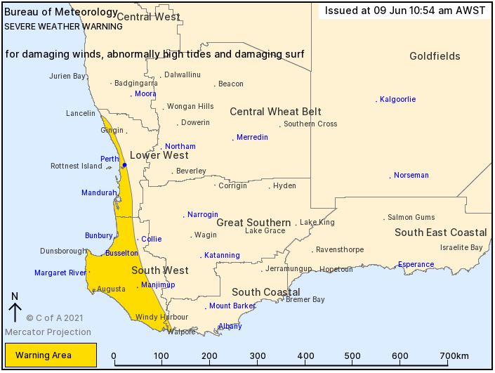
A low pressure system in the Indian Ocean will pass near the South West Capes late Wednesday and early Thursday. Strong to gale force northerly winds are occurring along the west coast prior to the passage of the low.
|
HIGHER THAN NORMAL TIDES may cause FLOODING OF LOW-LYING COASTAL AREAS along the west coast, particularly the Geographe Bay area. Once Thursday morning high tide has passed conditions may ease temporarily before the high tide on Friday morning where tides may be again up to 0.5m above the usual high tide mark. Note: northerly winds will help push the tide higher in these conditions. So, please would those on fixed jetties check the weights in their pens will allow for the higher than usual 'storm surge' tide.
|
DAMAGING WINDS with gusts to 100 kilometres per hour are possible south of Mandurah and could cause DAMAGE TO HOMES AND PROPERTY on Wednesday night and Thursday morning. Localised DAMAGING WIND GUSTS to 90 km/h are possible between Mandurah and Lancelin overnight Wednesday into Thursday morning.
|
Conditions are expected to ease during Thursday.
|
|

|
|
South of Perth Yacht Club
|
|
|
|
|
|
|